

Subscription required
Hurricane Isaias Updates: Storm Weakens After Florida Landfall as Flooding and Power Outages Spread
By Upright News Desk | October 10, 2026
Hurricane Isaias weakened to a Category 1 hurricane after making landfall near Destin, Florida, bringing damaging winds, dangerous storm surge, heavy rainfall and widespread power outages to parts of the southeastern United States. Although the storm has lost some of its strength, officials continue to warn residents about flash flooding, coastal hazards and the risk of further disruption as the system moves inland.
According to reports citing the US National Hurricane Center (NHC), Isaias was moving across the Florida Panhandle after landfall, with maximum sustained winds of approximately 90 mph (150 km/h) in the latest reported update. The storm is expected to continue moving inland, affecting parts of Alabama and the Tennessee Valley. Reuters report
Hurricane Isaias Latest Update: What We Know
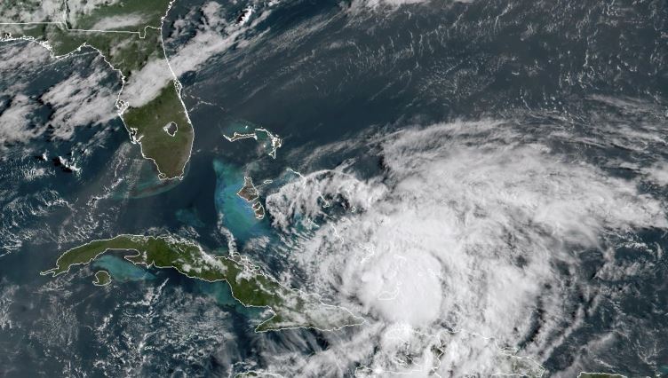
Hurricane Isaias brought severe weather to the northern Gulf Coast after strengthening over warm Gulf waters. The storm reached the coast near Destin, Florida, on Friday, October 9, before beginning to weaken over land.
Despite the reduction in wind speed, the hurricane continues to pose serious risks. Floodwater can rise rapidly in low-lying communities, while strong winds may bring down trees, damage buildings and disrupt electricity and communications.
The latest reported developments include:
- Landfall: Isaias made landfall near Destin in Florida’s Panhandle.
- Storm strength: The hurricane weakened to Category 1 after initially reaching Category 2 strength at landfall.
- Power outages: Hundreds of thousands of customers in Florida and Alabama experienced electricity disruptions.
- Flooding risk: Dangerous storm surge and flash flooding remain major concerns.
- Expected movement: The storm is forecast to move inland across Alabama and toward the Tennessee Valley.
Conditions can change quickly during a hurricane. Residents should consult official local weather alerts for the latest warnings and evacuation instructions.
Florida and Alabama Face Dangerous Weather Conditions
Coastal communities in Florida and Alabama experienced the effects of Isaias as powerful winds and rising water threatened homes, roads and other infrastructure.
The Florida Panhandle was among the areas affected by the storm’s landfall. Coastal flooding is particularly dangerous in areas where storm surge pushes seawater inland, potentially covering roads and entering homes and businesses.
Alabama also faced significant disruption as the hurricane’s circulation and rainbands moved inland. Strong winds, falling trees and damaged power lines can create hazards even in locations well away from the coast.
Emergency officials have urged residents to follow local instructions, avoid flooded roads and remain in safe locations while dangerous weather continues.
Widespread Power Outages Reported
The hurricane disrupted electricity supplies across parts of Florida and Alabama. Reuters reported that approximately 380,000 customers in Florida and more than 210,000 in Alabama were without power in the aftermath of the storm’s landfall.
These figures represent reported outages at the time of the cited update and may change as electricity providers restore service or additional disruptions occur.
Power outages can affect essential services, including communications, transportation, medical facilities and water supplies. Residents should keep mobile devices charged when possible and use battery-powered lights rather than open flames during outages.
People should also stay away from downed power lines and report electrical hazards to the appropriate authorities.
Storm Surge and Flash Flooding Remain Major Concerns
One of the most serious dangers associated with Hurricane Isaias is storm surge, which occurs when hurricane winds push seawater onto the coast.
Storm surge can inundate coastal neighborhoods, damage buildings and make roads impassable. Even after a hurricane weakens, elevated water levels and dangerous currents may continue to threaten people near beaches, bays and waterways.
Heavy rainfall presents another major risk. Water can accumulate rapidly in urban areas, drainage systems and low-lying locations. Flooding may also occur inland, where residents might not expect hurricane-related hazards.
Weather authorities have warned that dangerous conditions can continue after landfall. Residents should never walk or drive through floodwater because its depth and current strength may be difficult to judge.
Hurricane Isaias Expected to Move Inland
Following its Florida landfall, Isaias is expected to continue moving inland through Alabama toward the Tennessee Valley.
As the storm travels farther from the coast, its winds are expected to weaken. However, the system may continue producing heavy rain, damaging wind gusts and localized flooding.
Communities farther inland should not assume that weakening winds mean the danger has passed. Rainbands can produce hazardous weather, and saturated ground may increase the likelihood of flooding and falling trees.
The precise timing and severity of impacts will depend on the storm’s movement and the latest weather forecasts. Residents across the affected region should monitor official alerts throughout the weekend.
Safety Advice for Residents in Affected Areas
Emergency preparedness remains important while hurricane conditions and flooding risks persist.
Authorities recommend the following precautions:
- Follow evacuation orders. Leave designated evacuation areas when instructed by local authorities.
- Stay away from floodwater. Never drive through flooded roads or walk into moving water.
- Prepare for power outages. Keep drinking water, essential medicines, flashlights, batteries and a charged phone available.
- Avoid damaged infrastructure. Stay clear of fallen trees, unstable structures and downed electrical wires.
- Monitor official forecasts. Follow updates from the National Hurricane Center and local emergency management agencies.
- Check on vulnerable people. Help older adults, people with disabilities and neighbors who may need assistance, when it is safe to do so.
Anyone facing an immediate emergency should contact local emergency services.
Where to Track Official Hurricane Isaias Updates
Readers can follow verified information through these official resources:
- National Hurricane Center: https://www.nhc.noaa.gov/
- National Weather Service: https://www.weather.gov/
- NOAA Hurricane Isaias resources: https://www.noaa.gov/isaias
These sources provide storm advisories, forecast information, satellite imagery and weather safety guidance.
Frequently Asked Questions About Hurricane Isaias
Is Hurricane Isaias still dangerous?
Yes. Although Isaias weakened after landfall, dangerous storm surge, flash flooding, strong winds and power outages may continue to affect communities.
Where did Hurricane Isaias make landfall?
The hurricane made landfall near Destin, Florida, in the western Florida Panhandle on October 9, 2026.
Which areas are affected by Hurricane Isaias?
Florida’s Panhandle and parts of Alabama have experienced significant impacts. The storm is also expected to affect inland communities as it moves toward the Tennessee Valley.
Will Hurricane Isaias continue to weaken?
The storm is expected to weaken as it moves inland. However, heavy rainfall, flooding and damaging winds can remain dangerous even as hurricane strength decreases.
How can residents stay informed?
Residents should follow the latest advisories from the National Hurricane Center, the National Weather Service and local emergency management officials.
Conclusion
Hurricane Isaias has weakened after making landfall near Destin, Florida, but the threat to communities across the southeastern United States is not over. Flooding, storm surge, power outages and damaging winds remain important concerns as the storm moves inland.
Residents should continue following official warnings, avoid hazardous roads and remain prepared for changing weather conditions. Upright News will continue to monitor verified developments and report significant updates as more information becomes available.
Editorial note: This article is an original news-style report based on publicly available information. Figures and storm conditions reflect the cited reports available at publication time and should be checked against current official advisories before republication.